Nowcast of Aerospace Ionizing Radiation System
NAIRAS: Real-Time Aviation Radiation Nowcasting
The NAIRAS model, developed at NASA Langley, provides global, real-time predictions of atmospheric ionizing radiation exposure at commercial flight altitudes. Using data from galactic cosmic rays and solar energetic particle events, NAIRAS tracks how space weather affects radiation levels that can impact airline crews and passengers. This system fills a critical gap by offering radiation monitoring capabilities.
NAIRAS supports the aviation industry and frequent fliers by delivering vertical radiation exposure profiles from the ground to 100 km, helping guide safety policies, operational decisions, and long-term exposure assessments. Key development highlights include integrating a galactic cosmic ray model, achieving strong agreement with aircraft radiation measurements during major storms, real-time demonstrations at NOAA events, and multiple peer-reviewed publications.
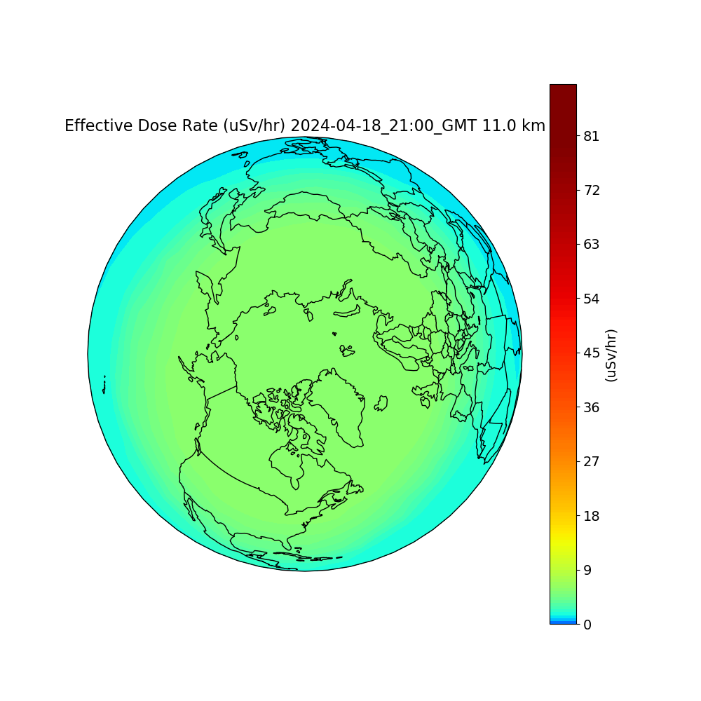
Current Effective Dose Rate Maps


View full documentation of NAIRAS here .
Major Stakeholders
- Commercial airline industry (including airline corporations and professional aircrew)
- FAA (Federal Aviation Administration)
- NIOSH (National Institute of Occupational Safety and Health)
- NOAA (National Oceanic and Atmospheric Administration)/SWPC (Space Weather Prediction Center)
- NASA CCMC (Community Coordinated Modeling Center)
- NASA Langley Research Center
- Space Environment Technologies
Data-driven predictions of biologically harmful radiation at commercial aviation altitudes
Developed at NASA Langley Research Center
