Commercial Data Service
For operational users in the aviation and aerospace community. Historical (up to 5-years in the past), current epoch, and future (near-term flight planning and far-term programmatic planning) time frames for radiation data are available.

Example Data Types
Explore some of our latest projects and tools developed for operational users.

Current Global Conditions
Global dose climatology and weather at 11 000 m altitude.
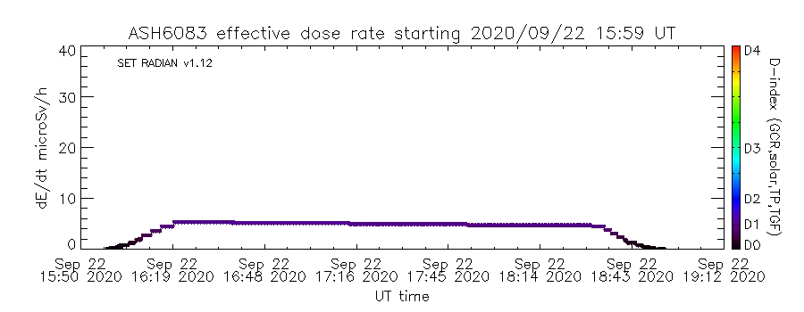
Current Flight Effective Dose Rate
Real-time flight radiation exposure visualization.
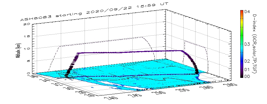
Current Flight Effective Dose Rate (3D)
3D visualization of dose-rate fields across flight paths.
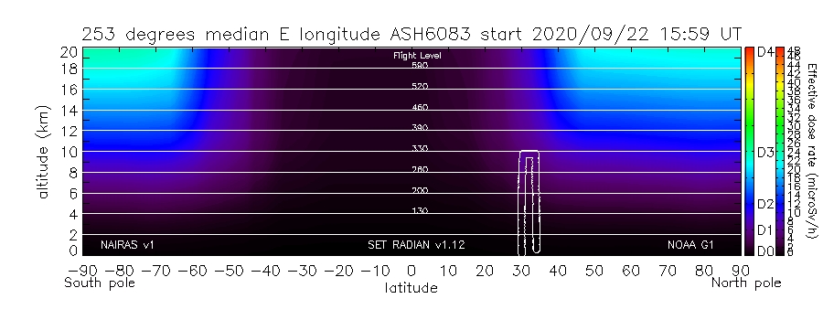
Current Flight Radiation Curtain
Radiation curtain view across aircraft trajectories.
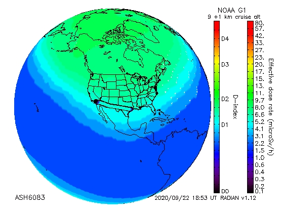
Current Flight Satellite View
Satellite projection of radiation exposure patterns.

Current Flight Summary
Summary of radiation metrics for selected flight paths.